- CCT Public Page
- [CCT Members Area]
Anyone know if the fire in the southwest has burned adamsfield?
According to the ABC -
"Firefighters are continuing their efforts to contain a bushfire burning out of control in Tasmania's remote South West Conservation Area. The fire was started by lightning in the World Heritage Area west of Maydena almost 2 weeks ago, and has burnt nearly 4,500 hectares. Remote area fire crews are continuing to extinguish hot spots using portable dams and with helicopter back-up. But the steep terrain, varying vegetation and limited water supply is expected to extend the time taken to extinguish the blaze. A spokesman says buttongrass moorland areas continue to re-ignite in the dry conditions. Authorities say it is unlikely any populated areas will be affected by smoke. All walking tracks including Timms Track, Clear Hill Road, Adamsfield Track, Saw Back Range Track and Richea Creek Track remain closed."
The map on http://fire.tas.gov.au shows it pretty damn close:
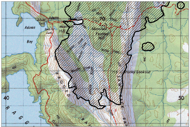
Could be a good opportunity for some exploring once it dies out if it has cleared scrub out. On the other hand bolts and rock at adamsfield could be buggered.
Overview
Content Tools