- CCT Public Page
- [CCT Members Area]
Blog from October, 2010
search
attachments
weblink
advanced
Overview
Content Tools
One thing I like about Climbing Magazine and their related website is the regular feature of a classic climb. I thought this would be a fun thing for The Sarvo too. My suggestion this week is Fiddlesticks. One of the few quality easier climbs on The Organ Pipes, it is found on The Flange - which is home to probably the greatest concentration of stars on The Mountain. Fiddlesticks stands out as a pleasant cruise amongst a slew of much more difficult routes for the novice to aspire towards, or simply as a bit of fun for more expert climbers. A little rattly lower down, the route gets better and better the higher you climb. These days, with sixty metre ropes, its level of enjoyment is enhanced if you climb it as a single monster pitch, finishing out on the arete to the left of the top V-groove. A wonderful route, well worthy of the three stars in the guidebook.
In the meantime, take a look at climbing.com's featured classic of the moment: Bishop's Terrace in Yosemite Valley. (I can personally vouch that this is a gorgeous route, maybe even as good as Fiddlesticks. Even if you are climbing much harder and are visiting the valley for more ambitious undertakings, it's a nice little gem to romp up during an "active rest" day.) Of special interest is the third paragraph, where one of our very own local climbers is mentioned.
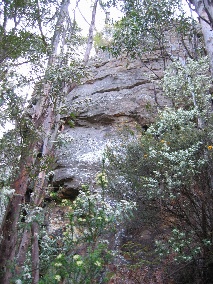
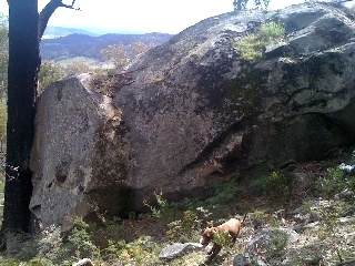
This one is another sandstone crag in the same belt of rock as sphinx and nieka. Its not worth walking to (30-40 mins) , but its a pleasant 15min mountain bike ride along the pipeline track startng at Nieka (Morphets Rd) and then a bit of a grunt up the hill. There is potential for only a couple of routes, and nothing that spectactular, but again I am surprised this has never been developed (although I think Dave Humphries might have done one trad route there a while ago).
About 3km along the track there is a blue water valve where a road goes down left. About 100m further on from this after a few slight bends there is a big burnt stump and a small cairn on the right side of the track. The Bumblebee boulder is visible in the bush 10m up the hill. Keep going past this about another 50m to concrete culvert where a creek comes down. Bash straight up the hill from here for 10min till you hit the crag.
There are quite a few other bits of sandstone along the track - both above and below the track. Further on there is quite a large chunk of obvious steep choss below the crag. There is also some limited potential on the dolerite at wellington falls which might be ok with the new track.

|
|

|

|

|

|

|
|
Previously on the Choss Files
The big jug finish and associated large block at the top of dead zone no longer exist.
They came out on Thursday while i was climing it, narrowly missing a few belayers below, but scoring a direct hit on my now ex climbing rope.
If you come to lead this climb, just be aware that the finishing moves pulling over the top are now significantly harder.
Hi all,
I've just moved here from the UK to work, and am looking for people to get out and about with, either as a one-off or more regularly. I live in Burnie but keen to travel and see plenty of Tassie, so no worries with scooting down to Hobart or elsewhere for a day. I lead about E2 5c UK trad, which seems to be about grade 19-20 here, but very happy to second harder stuff, or just hold the other end of the rope if it's way beyond me :o) I'm a friendly, down-to-earth sort of bloke, and a doctor if that's any use to you? And I make pretty good sandwiches..
If you wouldn't mind dragging me along, give me a shout either here, at robbie_lambert@hotmail.com, or on 0404 383 130.
Alternatively (and having seen the rather depressing number of previous partner posts with zero replies!), if here isn't the right place to do this, any hints on how best to find partners gratefully received..
Cheers folks,
rob
A mate and I tried to find the rap point to Arthur's Circus - Mt Wellington, and we failed!
The guide provides the details provided below, however they proved insufficient for our abilities :(
After driving to the top of the mountain, then walking down the track to the top of The Columns, we spotted a massive cairn located south, presumably above Central Buttress. We made our way to this cairn, however once there we were unable to find any rap point. From my marvellous vague description, can anyone shed light on where we were supposed to go from there? Had we perhaps found the "prominent cairn" mentioned in the guide? We were looking for some rap rings, however is one supposed to build an anchor at this point? What route is the big cairn above?
Much thanks to anyone who can help! :)
_____________________________
taken from thesarvo...
Arthur's Circus
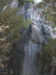
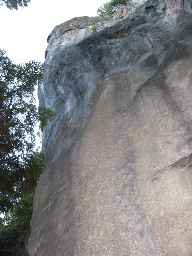
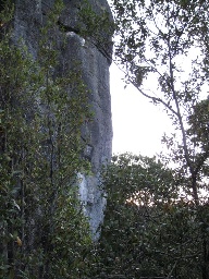
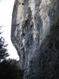
First of all, however, high on the L at the top of Pooch Gully, is a large reddish wall, Arthurs Circus, with a prominent inverted L-shaped crack. The routes, Line Tamer to High Wire, are probably best located from the top by following the cliff line round to south of the Bert's Fear top abseil (GPS MTW170. Note this abseil is below the cliff tops so don’t go down to it), then continuing easily on past Pooch Gully, still along the cliff tops, and descend to the top of the Circus. A prominent cairn can be seen at the top. (built May 2008). From here, abseil in. Alternatively, scrub bash up Pooch Gully... ouch. Positioned at the top of the cliffs Arthurs Circus catches the sun and is a good location for the cooler months. It is only 15 minutes walk down from the top of the mountain.
A new 3 pitch route has been bolted up to the ledge below the big roof at Fingal. It was done mainly as an access route to Supernaut (24) and other hard projects on the go, on the upper tier of the cliff. The route is fully bolted along with rap anchors, except for a short 15m section of trad gear where it links into Conan Macmorna for a bit. While not pretending to be a 3 star classic and done primarily for access to the upper tier, most of the route offers very good moderate climbing up to grade 19, despite two short manky sections. Combined with Supernaut (the best pitch at Fingal)it makes for 150m of good climbing. The route is likely to become popular in its own right as a moderate multi-pitch sport route. It is now possible to rap all the way down Supernaut and Tomorrows Dream via 4 abseils (double 60m ropes required)
Tomorrows Dream 100m 19 **
FA: Gerry Narkowicz and Andrew Martin. 23/10/10
More or less a direct line up the face to the big roof and bisecting Conan Macmorna at one stage. Start 20m right of Conan Macmorna. Pitch 1 (30m, 16). Delightful climbing up the black slab to a narrow ledge, then traverse right for 5m to the next line of bolts up a steeper slab to double bolt belay at apex of orange triangle of rock. 12 bolts. Pitch 2 (25m, 17) Climb the big diagonal of Conan Macmorna to the right for 15m with trad gear, to point opposite bolt on left face (1st manky section) Traverse left spectacularly via 2 bolts on small rail to middle of face, then straight up to belay at chains on big ledge. 2 bolts plus cams size 1-4 and long slings. Pitch 3 (45m, 19) Move belay 5m right to another double bolt belay. Lovely face moves up the next black face for 4 bolts, followed by a 10m section of mank up to the base of the amazing orange headwall. Superb face climbing (crux) up the orange wall on Arapiles like rock, to belay at chains on ledge below big roof. 13 bolts. Either rap from here (two raps to ground with double 60m ropes) or continue up to Supernaut. For Supernaut(24), traverse right along narrow ledge to tree via 2 bolts, then up easy slab to double bolt belay, a 20m easy pitch. The start to Supernaut is 10m higher to the right, and is best to belay on the ground opposite the climb, and not on the double bolt belay (this is a rap station for descent off Supernaut).
Gear: 16 draws required, cams 1-4, double 60m ropes. 20 draws if doing Supernaut.
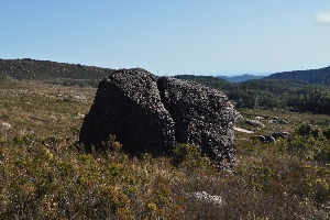
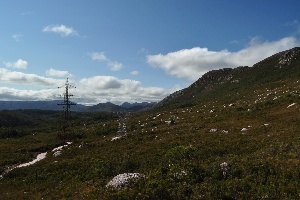
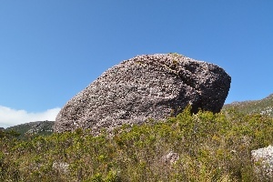
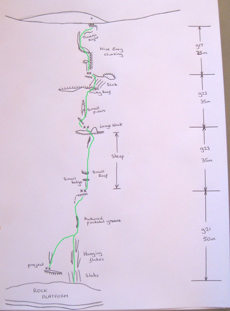
There is a massive field of boulders on the slopes leading up to the Tyndall Range, along the access road that follows the high voltage power lines south.
If you could get access to the road you could drive right to them, but with a 4 hour drive to get there, and west coast weather, they're not going to be developed anytime soon.
Map:
You can see the dozens of boulders on the map to the south of the marker, all the way to Lake Margret.
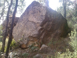
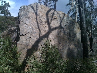
A couple of photos taken by Aaron Scott on a recent bush walk. The individual boulders dont look that much but you can see the number of boulders in the background:
|
|
|
|
Tyndall boulders. Photo Aaron Scott.
|
Tyndall boulders. Photo Aaron Scott.
|
Tyndall boulders. Photo Aaron Scott.
|
Previously on the Choss Files
Hey guys,
Just signed up. I'm mainlander wanting to come to tassie to play! I am planning to do a few climbs on Mt Geryon this summer and have a few questions that I am curious about.
First off I already have read this site and I have Climb Tasmania, is there much more information in the Chris Baxter guide? I'm not too fussed if there isn't much further stuff in the guides as I'm happy with the adventure. But its still good ask. I also have the notes from the original first ascent of the East Face which are an interesting read including a nice lead fall onto a hip belay!
Also how often are these routes climbed? Would you expect monthly visitation during the summer? Or something more sporadic?
Thanks guys,
Mark
A new route from Garry, on a new face - "on a whole new face on mt brown. We named it the Hidden Face its 150m high and is awesome. Faces south and is 500m around right of the othe one"
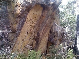
There are some very obvious large free standing boulders that you can see on the opposite hill (to the east) as you drive up to handsome crag.
There are about 6 to 8 quite large boulders. The rock is very mixed - some ok, some real choss. About the same as the Weakhold. Probably potential for 20-30 problems.
If you could drive up the road, they would get developed for sure as it would be less than 5 min walk.
But the road is very washed out and you need a proper 4wd. To walk from the main road is 20 - 25 minutes and a bit too far for the quality of whats there. I guess the road could be fixed up but that would be heaps of work.
Access is pretty simple - the GPS track and map says it all:
Some photos:

|

|
|

|

|

|

|

|
|

|
|

|

|

|

|

|
|

|

|

|
Other Choss Files
I seem to remember seeing an advert for the Reel Rock Tour to be held in Hobart later today... but I can't find any info on the web as to where/when... anyone out there got the answers?
I went up to Northern Buttress last Saturday with Deano "The Carrot Eradicator" and together we removed all the old gear and re-equipped it with U's. Now much improved.
As an aside, our discussions that day included the vexed topic of "stars" are the perrenial question: "Are they being doled out too freely"? By Deano's view everyone's gone soft and they should be assigned as parsimoniously as Michelin stars. I didn't take the conversation as far as "How many do you thing Boys Games in now worth"? as that may have put him in an embarassing situation (especially since some versions of Craglets sprayed stars around like they were going out of fashion!). I am content to say that whetever number the old route was given, they are now more justified.
Dean has been doing some great work with the Rob De Ceasare carrot puller. Check out Upper Teardrop Gully.
Went and did "Left Out" on " Step Tier" last night. Whats with the description? Doesn't say anything about climbing the first pitch of Moonraker?
Can I suggest a few changes? Maybe could be edited to say "A gob smacking sustained pitch. Climbs the face L of 2nd pitch of Moonraker
and in the Moonraker description the pitches should read as 1a. 30m & 1b. 30m (not 2b. 30m) also Nick's Moonraker picture in the guide says 15 instead of 16?
Jed
Last summer Claire and I established some fun problems up at Boat Harbour. The problems were up to about V1 - V6 with potential for a few harder ones, take my grade estimates with a grain of salt, it's a while since I did the problems and I didn't write anything down. . There is potential for about 10-15 problems.
The problems can be found by walking a hundred metres or so around the coastline to the north of the beach. 


Here are a couple I discovered last summer. Very worthwhile for anyone living up that way.
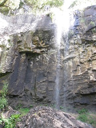
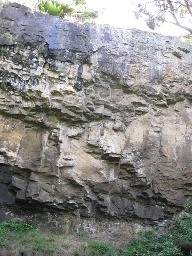
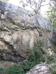
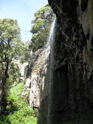
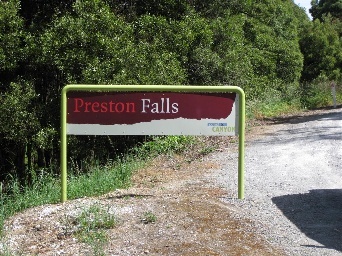
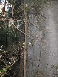
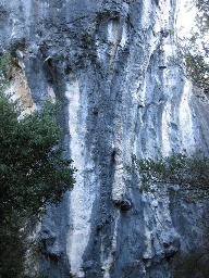
Preston Falls
Overhanging basalt.
http://www.world-of-waterfalls.com/australia-preston-falls.html
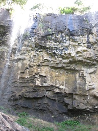
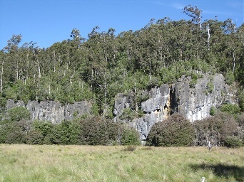
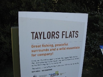
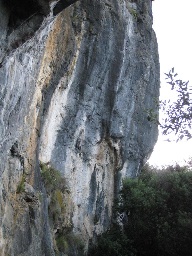
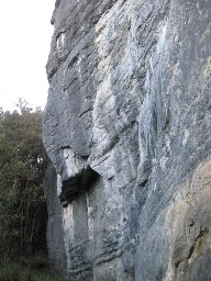
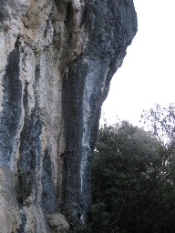
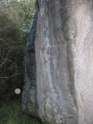
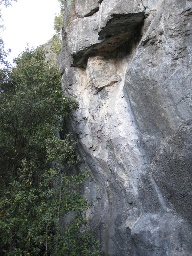
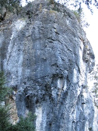
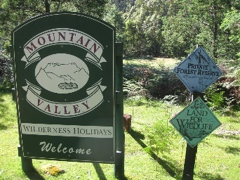
Taylors Flats
Limestone cliffs up to 25m high, vertical to gently overhanging with some tuffas! Has some great potential but is on private land so the first people to climb here will need to discuss with the land owners.
http://www.mountainvalley.com.au/contact.html
Preston Falls and Taylors Flats Cliffs |
|||
|---|---|---|---|
|
|
|
|
|
|
|
|
|
|
|
|
|
|
|
|
|
|
|
|
|
|||