- CCT Public Page
- [CCT Members Area]
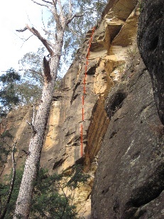
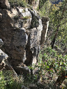
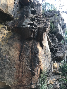
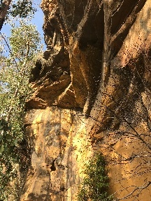
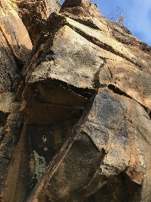
glen dhu sorta solid roof.JPG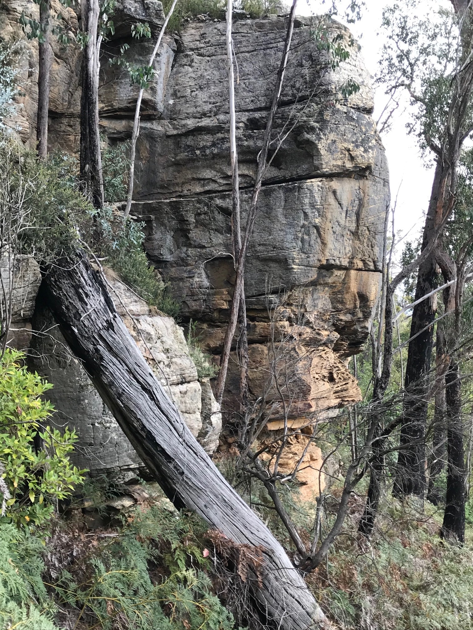 I haven't written up some choss in a long time, but this one
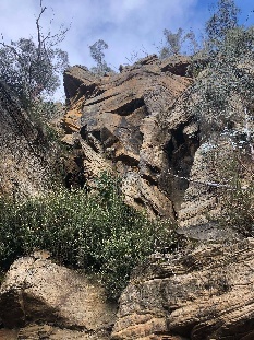 is an almost-good-enough cliff that's obvious on a map, that will no doubt get visited again, but probably just a bit too much effort to get to.
I went for a walk on the Glen Dhu Trail on sunday, which goes around the flanks of Collins Cap. It's quite close to the Yellow Cliffs - subject of a previous episode: The Choss Files - Glen Dhu Rd
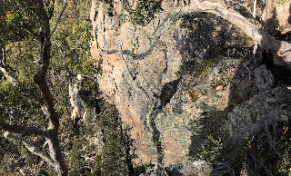
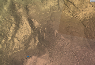
The cliff itself is quite obvious on a satellite or lidar map see Google map - and was pointed out to me by Dave Thomas.
I parked at the cattle yards where there is a gate across the road on Nicholls Rd and walked from there. The first part of the trail is across private land until you get into the Wellington Park, but the people in the house seemed fine with people walking it.
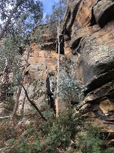
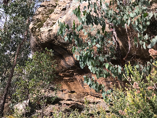
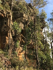
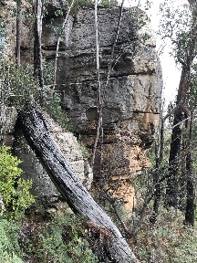
Its a nice flat walk for half an hour past various bits of small choss, until the track starts zig zagging up the hill in some switch backs. When I could first see the cliff I started contouring across the hillside to it - this was probably a mistake as the hillside is steep AF. On the way back I walked from the top of the cliff, which is flatter, but still not easy walking through regrowth. Would need a track for sure.
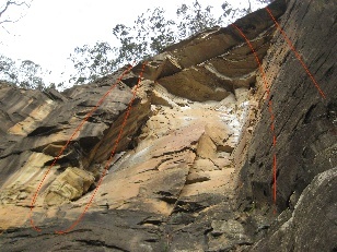
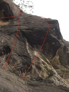
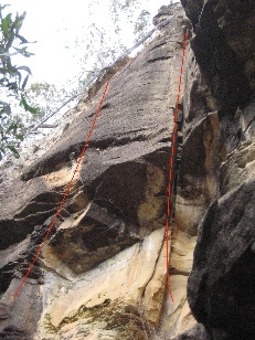
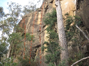
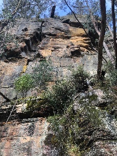
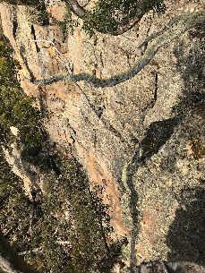
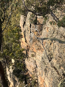
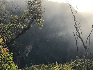
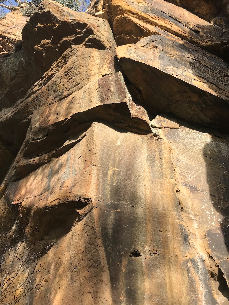
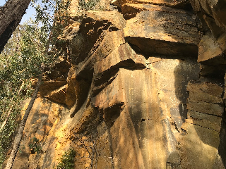
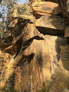
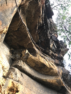
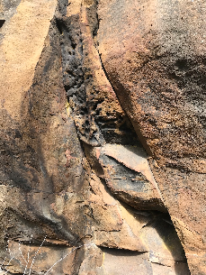
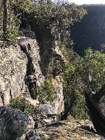
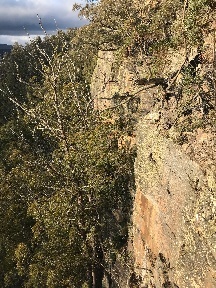
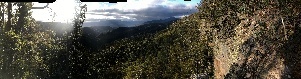
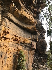
The cliff has some ok looking sandstone, some of which would be over 30m high. Its at about 700m elevation, so probably part of the same layer of sandstone as Neika/Springs/Sphinx. It's NNW facing, so had some nice afternoon sun, and a beautiful view over the valley towards Mt Dromedary.
There would be at least a dozen routes there I would have thought. But, its probably just a bit too much effort to get to, at 45/50+ minutes walk, with a steep uphill pinch and not easy walking at the end to gain the cliff. So probably destined to remain a curiosity, but maybe others will disagree.
|
|
|
|
|
|
|
|
|
|
|
|
|
|
|
|
|
|
|
|
|
|
|
|
|
Hillshade map of the area
|
|||
|
|
|
|
|
|
|
|
Other choss files:
Overview
Content Tools
2 Comments
Hamish Jackson
Hey Jon,i went up here the other day having somehow only noticing your Glen Dhu Yellow cliff choss file entry! I took the flat contour access across top the summit, then scrambled down. I did think this crag showed some promise with the rock architecture being quite impressive in places. Anyway, i might go back once i have a ebike - it would be nice to have another winter crasg option, even if it is only a dozen routes. I've added a couple more photos for further interest.
Thomas Fulton
Hey Jon and Hamish,
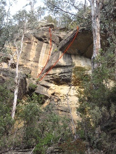
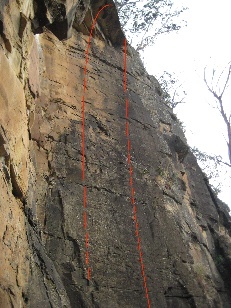
Myself, Rolan Eberhard and Pat Eberhard also checked this out a few years back. I'll upload some more photos. There were certainly some really good looking lines, the cliff was up to 40m tall in parts. We approached from the bottom with Land owners permission but it was a tough, steep bushbash up the hill (more than an hour), so much so that we rote off the idea of future climbing there... but we didn't check out the access from the top. Sorry about the red lines in the photos, I saved them like that years ago. All the best to whomever takes interest in the place. Also let me know if you need someone to haul bags or belay for hours - happy to help out.